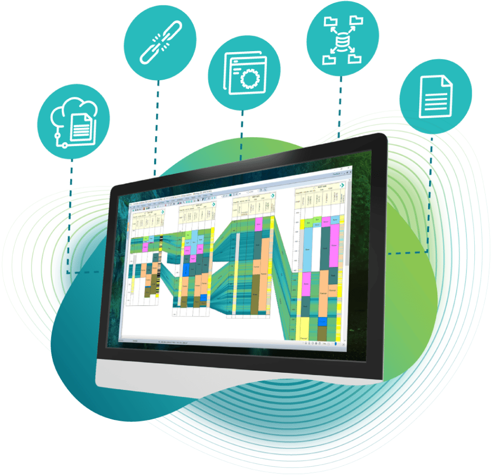
Stratigraphic Awareness in IC
Build and use Stratigraphic schemes to use with various data, e.g. biostrat. lithostrat. chronostrat. Include the latest ICS Scheme to build and correlate beyond local lithostratigraphic variations to see the geological time, big-picture for your basin.
Identify potential stratigraphic traps or simply map local unconformities quickly when evaluating your zones; IC's stratigraphic awareness can help.


Fuziana Rozalli
Lead Technical Support, IC
“Quit the guessing game or spending too much time checking on each zone manually. IC Stratigraphy is a powerful tool which allows you to generate the most probable results automatically by quickly identify missing zones and unconformities when building zonal analysis or gridding zonal data values.”
-
Build related data from a single dataset, tops can become zones, that can build ages and additional zonal data as well as specific lithologies
-
Build age/depth mapping to display wells in chronostratigraphic age
-
Maintain control over stratigraphic relationships through user-defined dictionaries
-
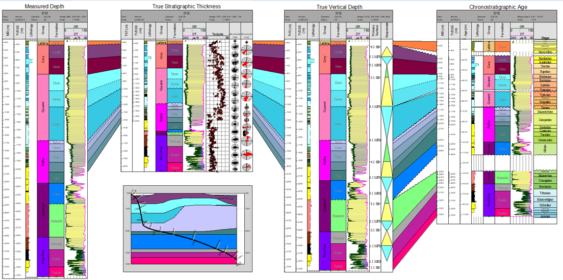
Calculate True Stratigraphic Thickness
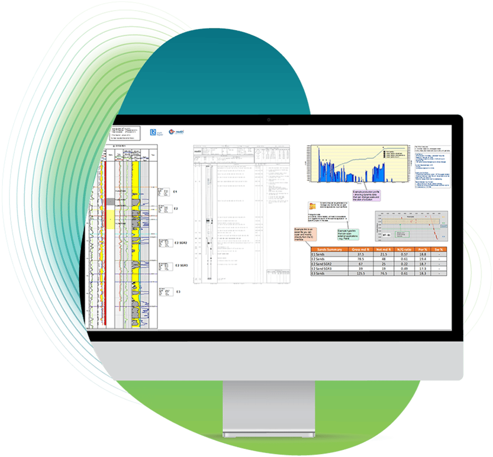
Pictured: Stratigraphic Schemes can build new data based on the applied relationships as a guide. Interactive editing, gridding and zonal mapping reporting can tie back to these relationships.
- Quickly display step-changes in zonal analysis mapping based on known stratigraphic relationships
- Plot your well data by Age or True Stratigraphic Thickness as well as TVD or MD
- Generate Well driven Wheeler diagram correlations
- Generate regional correlation by removing local naming inconsistencies for a standardised (ICS) view
- Generate Sequence Stratigraphy plots for sediment supply or accommodation space are desired
- Generate Stratigraphic grids quickly for log statistics, thickness, named attributes or depth.
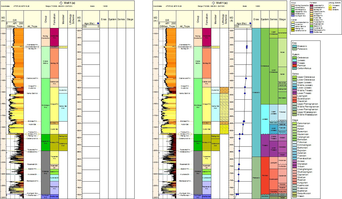
Pictured: Flexible displays allow a multitude of depth references to drive correlation or single well plots. TST, Age as well as MD TVDSS and TVD can highlight subsurface variations easily.

Toolkits