Powerful and consistent visualisation produces coherent results for efficient and confident decision making.
Enabling confident insight through powerful visualisation.
IC 2023 OUT NOW
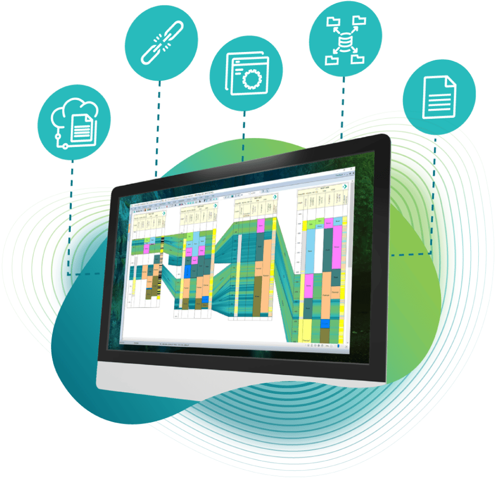
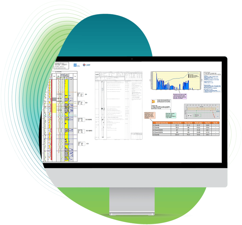
Our IC software gives stratigraphers, geologists, petrophysicists, engineers and data managers a new view of their subsurface well data. Bringing all your data together, with tools to interrogate, analyse and visualise it, IC saves you time and effectively leads you to confident, data-driven conclusions.
Powerful and consistent visualisation produces coherent results for efficient and confident decision making.
Easy to use tools quickly improve your regional perspective while maintaining the detail when interpreting your subsurface.
Import data from anywhere into a flexible database and share easily between teams for a broader and deeper understanding of your reservoir.
Incomparable stratigraphic awareness gives a faster and more confident understanding of your subsurface, unconformities and all.
Acquiring subsurface data can be costly and challenging. Once it’s in your possession, you need to see the full scope of its insight. Thinking like a geologist, IC brings all your well data into one place, then gives you the interrogation and visualisation functionality you need to identify what it’s telling you and make confident decisions for all of your well and field optimisation projects.
Geoactive’s subsurface software applications are built on a breadth of experience across each facet of the energy industry. Every day, we apply our independent expertise to help clients increase performance from their upstream and downstream operations and assets. We’re constantly developing and innovating to deliver solutions to the most complex challenges across the lifecycle of any asset.
Download The Latest IC Brochure
“I have been using ODM/IC since 2007, when I came across it whilst looking for a PC well database and correlation package, which provided a high functionality and low-cost solution. Since then, I have used ODM/IC for nearly all projects I have been involved with whilst working as either a contractor or in an exploration company."
"IC is fantastic! We have just never seen our data like this before."
“I have been using IC in single-well to multi-well (>250 wells) projects for Appraisal, New Ventures, and Development work worldwide IC’s flexibility to handle most data types, from simple log curves to complex sedimentological interpretations, production data, reservoir zonation, dip-meter, to name a few, is outstanding in comparison to its competitors."
“ODM/IC has allowed me to build comprehensive well databases within which I can integrate most well data types for stratigraphic analysis and depositional system mapping. Most recently, this has involved building a regional scale database of wells in the UK & Faroes West of Shetland province, for the purposes of play mapping and prospect evaluation, a function for which other widely used software packages are not currently suitable.”
"IC gives Geoscientists true flexibility to interpret, draw and present technical work of high quality. IC’s portability allows me to work on the move and to present and discuss my work with my teams and Management anywhere/anytime.”
For years, we have continued to build on our understanding of what you need to ensure consistent and powerful interpretations of your subsurface data. Click on each section below to read more about each of our four cornerstone toolkits.
Integrate disparate data sets to allow your entire team to work together flawlessly.
Generate the most up-to-date data review summaries and map displays for your wells quickly.
Utilize an understanding of the stratigraphic relationships encountered downhole across your database.
Pull in the history of your energy production to create dynamic reviews with up-to-date field understanding.